TODAY I LEARNED: WHY TIMOG IS 'TIMOG,' AND NOT SOUTH AVENUE
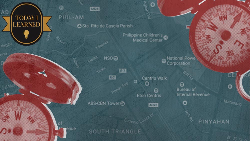
Somewhere near the Quezon Memorial Circle in Quezon City are roads named West Avenue, East Avenue, North Avenue, and Timog. For the unfamiliar, it may seem like a random labeling of the major thoroughfares in the north of Metro Manila, but residents and motorists probably know that the four are actually connected to one another.
If you look at the map, North Avenue, West Avenue, East Avenue, and Timog complete the sides of a perfect square. North is at the north (or the topmost part) of this square, East and West on the sides, and South/Timog at the bottom.
ALSO READ
How a President's Dream of the Perfect City Became Quezon City
10 Names of Places That Are Actually Filipino Words
But why is Timog not called South Avenue?
Let's start with the interesting history of Quezon City's urban planning.
Quezon City was intended to be the Philippine capital that would replace Manila. And it did serve as the new capital city for three decades, from October 12, 1949 to June 24, 1976. The status was returned to the city in the west, and that was the end of what could have been a well-planned city with housing projects, a Constitutional Hill with the three branches of the government, and a quadrangle reminiscent of New York's Central Park counterpart.
Quezon City as the New Capital
Quezon City, named after President Manuel Luis Quezon, who envisioned it as a new seat of government, was incorporated as a city on October 12, 1939.
The 1930s was a time when Manila—specifically in Binondo, Intramuros, Quiapo, San Nicolas, and Tondo—was at the mercy of rapid urbanization as sanitation, traffic congestion, and overcrowding became apparent. As a result, suburbs outside the city limits developed, giving way to the Greater Manila Area. This included the rise of real estate opportunities in Pasay, San Pedro Makati, San Felipe Neri (eventually renamed Mandaluyong), San Juan del Monte, and San Francisco del Monte, where middle- and upper-class residents started to reside to escape the congestion in the city. Politicians (including Quezon) tried to expand the borders of Manila, but were rejected by the body; instead, the president proposed to build an entirely new city in 1938.
Quezon City, in its early years, was a rural area. It was founded, after all, from several barrios carved out from already existing towns. These were the barrios of Bagubantay (Bago Bantay), Balintauac (Balintawak), Loma (La Loma), Santol and Masambong, which were taken from Caloocan; the barrios of Cubao, Diliman, and San Francisco, which were taken from San Juan; the barrios of Jesus de la Peña and Tanong, including the new UP site, which were taken from Marikina; and, the barrio of Ogong (Ugong Norte), which was taken from Pasig. Eight estates near Manila were also bought by the government, including Diliman Estate as the centerpiece. The decision to get Diliman was upon the advice of American architect William E. Parsons.
Quezon City's Center: The Diliman Quadrangle
When Parsons died in December 1939, planning was turned over to Architect Harry T. Frost, who worked with Architect Juan Arellano, Engineer Alpheus Daniel Williams, Architect Juan Arellano, Architect Louis Croft, and Architect Welton Becket. The original plan was to have a 400-hectare park at the core of the new city, which is about the size of New York's Central Park. This was supposed to be called the Diliman Quadrangle, which was to be defined by North, South, East, and West Avenues.
East Avenue was the first to be developed as a paved road in 1940.
The cardinal directions in a diamond pattern were planned to be bisected by the North–South Circumferential Road at the northern and southern corners of this Diliman Quadrangle, with the Quezon Boulevard Extension (now Quezon Avenue and Commonwealth Avenue) passing through the eastern and western corners.
North and East Avenues intersect at the 25-hectare elliptical site, which was originally planned to hold the Capitol Building for the Philippine Legislature, the new Malacañang Palace on North Avenue, and the Supreme Court Complex along East Avenue. (The Capitol Building did not push through, and it's now the Quezon Memorial Circle; the site of what was supposed to be the Supreme Court is now the East Avenue Medical Center; and the planned Executive Mansion is now the Veterans Memorial Medical Center.)
The south side of the capitol was intended to have residential relocation sites as well as military and constabulary camps (Crame and Murphy). The north side, on the other hand, has the University of the Philippines and what was supposed to be the Philippine Military Academy (now the Batasan Hills Complex).
Before the Japanese occupation on December 8, 1941, all roads in the Diliman Quadrangle were completed. But the construction of all structures, except for parts of the University of the Philippines, was put on hold.
Quezon City During World War II and Renaming of the Streets
Executive Order No. 110, signed by the Chairman of the Philippine Executive Commission Jorge B. Vargas, was issued on December 8, 1942. Vargas' authority was conferred by the Commander in Chief of the Imperial Japanese Forces in the country.
The EO effectively changed the names of streets and public places in the Philippines, which was in line with Japan's objective to construct a "New Philippines." The first step was to reduce the cultural influence of the West, specifically Anglo-American, and this went from changing the education policy to switching out names of streets, roads, bridges towns, and public sites that honor American names. Some streets with names of American presidents and officials were swapped with Japanese names. Other places with English words are changed with Tagalog substitutes. This had undertones of using Filipino nationalism to gain support for the expanasion of the Japanese empire, but that's fodder for another discussion.
In Quezon City, Central Boulevard was named Banahaw and Main Avenue was named Pangulo. Streets in Project 5 were renamed after Philippine provinces: Antique (New York Street), Davao (Maryland Street), Lanao (Columbia Street), and so on. Broadway Avenue became Biak-na-Bato, Pacific Avenue (now Doña Hemady Avenue) became Sulu, and Gilmore Avenue used to be Tagumpay.
Obviously, this also called for the renaming of the newly constructed Commonwealth Roads. North Avenue became Hilaga, West Avenue became Kanluran, East Avenue became Silangan, and South Avenue became Timog. The street names were reverted to the original post-war.
Renaming of Streets in South Triangle
On July 28, 1963, 20 Boy Scouts (aged 13 to 21) and four scoutmasters perished in a plane crash at the Bay of Bombay. They aboard were aboard United Arab Airlines Flight 869 and on their way to the 11th World Scout Jamboree (August 1-11, 1963) in Marathon, Greece.
To "honor and perpetuate the memory of 24 Boy Souncts and Scouters," Quezon City Resolution No. 6692, S-64 was adopted on April 14, 1964. It resolved to rename several streets south (Homesite Project 1) of Barangay South Triangle, which were originally named based on the fact that they radiate from the south side of the Diliman Quadrangle and their street number (i.e. South 2, South 3, South 4, etc. and South C, South D, South E, etc.). The streets still carry the names of the fallen Scouts: Albano, Bayoran, Borromeo, Madriñan, Rallos, Limbaga, Fernandez, Fuentebella, Gandia, De Guia, Delgado, Lozano, Castor, Magbanua, Ojeda, Chuatoco, Reyes, Santiago, Tobias, Tuason, Torillo, and Ybardaloza. South B became Marathon Street, and South I became 11th Jamboree Street.
The Resolution also moved to rename South Avenue to Boy Scouts Avenue. But this was reverted to Timog Avenue in 1965.
Interestingly, Timog Avenue was moved to be renamed Carlos P. Garcia Avenue through Batas Pambansa Blg. 685, An Act Renaming Timog Avenue and East Avenue as Carlos P. Garcia Avenue. It was approved on March 7, 1984, and effectively changed the name of two avenues in Quezon City: "one known as Timog Avenue, from Quezon Boulevard Extension to Epifanio de los Santos Avenue, and the second, known as East Avenue, from the said Epifanio de los Santos Avenue to the Quezon Memorial Circle."
The name, obviously, did not stick. And we're now still using Timog Avenue (formerly Carlos P. Garcia Avenue in 1984, formerly Timog Avenue in 1965, formerly Boy Scouts Avenue in 1964, formerly South Avenue post-war, formerly Timog Avenue in 1942, and formerly South Avenue).
References:
"An Act Renaming Timog Avenue and East Avenue as Carlos P. Garcia Avenue." The Bookshelf of the Judiciary
Gosiengfiao, Victor. "The Japanese Occupation: 'The Cultural Campaign.'" Philippine Studies, vol. 14, no. 2, Apr. 1966, pp. 228-42. JSTOR.
Olivares, Lakan. "Quezon City: World War II in Quezon City 1941-1945." Lakbay ng Lakan, 16 Feb. 2021
Olivares, Lakan. "Diliman Quadrangle, Quezon City: The History of East Avenue and Its Government Institutions." Lakbay ng Lakan, 26 July 2020.
Olivares, Lakan. "Diliman Quadrangle, Quezon City: The History of East Avenue and Its Government Institutions." Lakbay ng Lakan, 9 May 2020.
Ocampo, Ambeth R. "Street Names: Remembering and Forgetting." Philippine Daily Inquirer, 23 Oct. 2020.
Quezon City Public Library Local History Section. "Renaming of South Streets in Honor of the Boy Scouts Who Perished in the Plane Crash". July 2013.
Tan, Miguel Lorenzo J. "Street Naming and Odonymy in Quezon City." UP Working Papers in Linguistics, vol. 2, no. 2, 2023.
2024-09-19T08:06:44Z dg43tfdfdgfd